 NERC Data Catalogue Service
Coal exploration
Type of resources
Topics
Keywords
Contact for the resource
Provided by
Years
Formats
Representation types
Update frequencies
Scale
-
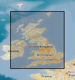
The map shows the location and line-identifiers of reflection seismic profiles acquired by the former National Coal Board and British Coal during their exploration for coal in the UK. Ownership of UK coal exploration data was transferred to the Coal Authority following privatisation of the UK coal industry. The Coal Authority have appointed the British Geological Survey as custodian of this important national geological data archive. These data are, in general, publicly available; however, access to data within active mining licences is restricted in that it requires the consent of the mining licensee. The Coal Authority data archive includes hardcopy and digital data for the reflection seismic profiles, such as film and paper prints, original field tapes, demultiplexed data, processed stacked data, navigation (location) data and observers' and surveyors' acquisition reports. But please note that not all data types are available for all profiles. The BGS will be pleased to provide information on data availability for named profiles or within specified geographic areas, together with cost estimates and options for supplying copies.
-

The map shows the location and names of boreholes with digital geophysical logs acquired by the former National Coal Board and British Coal during their exploration for coal in the UK. Ownership of UK coal exploration data was transferred to the Coal Authority (Coal Authority) following privatisation of the UK coal industry. The Coal Authority have appointed the British Geological Survey as custodian of this important national geological data archive. These data are in general publicly available; however, access to data within active mining licences is restricted in that it requires the consent of the mining licensee. The Coal Authority data archive includes digital data for some of the geophysical borehole logging. These are mainly in the form of original field tapes; however, also available are some data transcribed onto more modern media during BGS projects. The BGS will be pleased to provide information on data availability for named boreholes or within specified geographic areas, together with cost estimates and options for supplying copies.
-
The UK contains extensive resources of coal, both at surface and in the subsurface. It is estimated that onshore these surface and subsurface deposits cover an area of approximately 40,000 km2. This dataset is derived from a 2004 study to assess the potential of the UK onshore coal resources for both exploitation by conventional (mining) and new technologies. Digital data was created using a Geographic Information System (GIS) to produce the delivered output of the original project, a series of paper maps that would identify prospective areas. The dataset layers include: Mining Technologies: Area with technical potential for opencast workings (source Coal Resource Map of Great Britain BGS/Coal Authority 1999) Underground mining exploration prospects Good prospects for abandoned mine methane (AMM) (Mine workings not recovered) Resource area for coal mine methane (CMM) (source Coal Authority Underground Licences, May 2002) Extent of underground workings with 500m buffer zone (based on Coal Authority data, May 2002) New Technologies: Area greater than 1200m from surface with potential for CO2 sequestration Area with good coalbed methane (CBM) potential Underground coal gasification (UCG) potential Coalbed methane (CBM) resource area Coal-bearing strata